

Reported by: Ijeoma G | Edited by: Oravbiere Osayomore Promise.
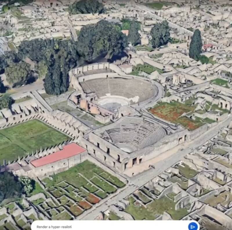
Google Earth has quietly removed a newly introduced artificial intelligence tool that allowed users to generate realistic but entirely synthetic satellite images, following a swift and sharp backlash from researchers, open-source intelligence experts, and misinformation watchdogs who warned that the feature could become a powerful weapon for disinformation. The tool, which was rolled out on Thursday, July 30, 2026, integrated Google's advanced Nano Banana 2 image-generation technology, enabling users to zoom in on any location on Earth and, within seconds, produce convincing AI-generated imagery that mimicked real satellite and aerial photography.
The feature was initially presented as a creative and educational tool, allowing users to visualise changes to landscapes, simulate urban development, or imagine historical transformations of familiar places. However, within hours of its launch, concerns began to mount across social media platforms and academic circles. Researchers and open-source intelligence (OSINT) analysts pointed out that the same technology could be used to fabricate evidence of military movements, environmental disasters, or geopolitical events, potentially fuelling disinformation campaigns with imagery that is nearly indistinguishable from genuine satellite data.
A statement from Google Earth, seen by multiple news outlets, acknowledged the concerns and confirmed that the feature had been taken down. "We are committed to the responsible development of AI technologies," the statement read. "After careful consideration of feedback from the research community, we have decided to remove the AI image generation feature from Google Earth to prevent its potential misuse. We will continue to explore ways to make AI tools available safely and transparently." The company did not provide a timeline for a potential relaunch, saying only that it would "re-evaluate the feature with additional safeguards."
The Nano Banana 2 model, which powered the tool, is a successor to Google's earlier Nano Banana image generator, which had already gained attention for its ability to produce high-quality visuals from simple text prompts. The new iteration was integrated into Google Earth's interface, allowing users to select a location, type a description, and generate a satellite-style image of that place as it might appear under different conditions—such as after a flood, a forest fire, or a new construction project. While the technology was impressive, its potential for abuse was immediately apparent.
One open-source intelligence analyst, who spoke on condition of anonymity, told reporters: "This tool essentially allows anyone to create a fake satellite image of any place on Earth. In the hands of bad actors, it could be used to create false evidence of troop movements, environmental catastrophes, or even territorial violations. The implications for international security and public trust are enormous." Another researcher, specialising in geospatial analysis, added: "We've long worried about the potential for AI to be used to generate synthetic satellite imagery. Seeing it integrated into a platform like Google Earth, which is widely trusted by journalists, policymakers, and the public, was deeply alarming."
The backlash was amplified by concerns that the tool lacked adequate watermarking or provenance features that would allow viewers to distinguish between real and AI-generated imagery. Without such safeguards, the synthetic images could easily be shared on social media or even used in news reports, spreading misinformation with potentially serious consequences. The removal of the tool has been welcomed by many in the OSINT and fact-checking communities, but it has also reignited a broader debate about the responsibilities of tech companies when deploying powerful AI technologies.
Google's decision to pull the feature just days after its launch reflects the growing sensitivity around AI-generated content and its potential to undermine trust in visual evidence. The company has faced similar controversies in the past, including criticism over its AI-powered search features and image generation tools. However, the speed with which it responded to the backlash over the Google Earth tool suggests that the company is acutely aware of the reputational risks associated with enabling the creation of highly convincing fake geospatial data.
The incident also highlights the challenges facing tech companies as they race to integrate AI into their products. While the potential benefits of AI-powered tools are immense, so too are the risks. The Google Earth AI tool was designed to be a creative and educational feature, but its removal underscores the difficulty of predicting how such tools will be used once they are released into the wild. As one industry observer put it: "Google has shown that it can move quickly when it needs to. But the question remains: why wasn't this foresight applied before the tool was launched?"
As of Saturday, August 1, 2026, the feature remains unavailable, and Google has not announced any plans to reintroduce it. The company is expected to engage with researchers, policymakers, and civil society groups to develop a framework for the responsible deployment of AI-powered geospatial tools. In the meantime, the episode serves as a stark reminder of the double-edged nature of AI innovation and the urgent need for robust safeguards to prevent its misuse.
📩 Stone Reporters News | 🌍 stonereportersnews.com
✉️ info@stonereportersnews.com | 📘 Facebook: Stone Reporters News | 🐦 X (Twitter): @StoneReportNew | 📸 Instagram: @stonereportersnews
Add comment
Comments