

Published by Osasere Edomwonyi Ikpoba
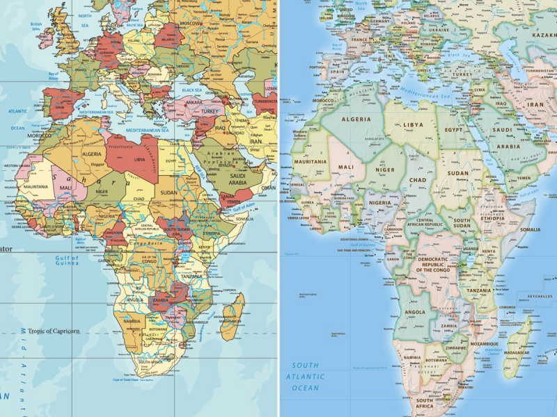
The United Nations General Assembly has voted overwhelmingly to adopt a new world map that accurately reflects the true size of continents, delivering a historic rebuke to the 450-year-old Mercator projection that for centuries has visually shrunk Africa while inflating the landmasses of Europe and North America. The landmark resolution, spearheaded by Togo and backed by all 55 African Union member states, passed on Friday with 164 votes in favour, six abstentions and a solitary vote against by the United States, which denounced the initiative as an "ideological agenda" undermining the UN's credibility.
The "Correct the Map" resolution promotes the adoption of the Equal Earth cartographic projection, developed in 2018 by an international team of cartographers, which more accurately portrays the relative surface areas of continents. The Mercator map, designed in 1569 by Flemish cartographer Gerardus Mercator to aid European sailors in maritime navigation, has long been criticised for its profound distortions. It makes Greenland appear roughly the same size as Africa, when in reality the African continent is 14 times larger. The resolution seeks to address what proponents describe as a colonial-era injustice that has shaped global perceptions of the continent for nearly half a millennium.
"Africa, once diminished on maps, now insists on being seen at its true scale – geographically, historically and politically," the resolution declared, according to reports from the assembly. Togo's Foreign Minister Robert Dussey, who led the campaign, told the General Assembly that maps are "never neutral." "They guide education, nourish the imagination, and influence collective perceptions. When they present a distorted image of our planet, they risk perpetuating inaccurate representations that are passed down through generations," he said. Ahead of the vote, Dussey had told Reuters: "A fair world begins with a fair map."
The resolution does not ban the Mercator projection, acknowledging its continued suitability for maritime and aerial navigation. Instead, it urges member states, international organisations, schools, media outlets and technology companies to phase out its use in favour of equal-area projections that provide a more geographically honest representation of the world. The vote is non-binding, but supporters hope it will lead to sweeping changes in classroom curricula, digital platforms, and institutional mapping practices worldwide.
France, which co-sponsored the resolution, announced on Friday that it would abandon the Mercator projection entirely. Foreign Minister Jean-Noël Barrot, speaking at the Sorbonne University in Paris, said the traditional map gives "the United States, Russia and China a disproportionate visual prominence compared to Africa, Latin America or southeast Asia," while "Greenland appears almost as big as Africa." He acknowledged that "changing maps obviously doesn't change the world," but added: "Correcting a distorted representation is already an act of truth." France's move is widely seen as part of a broader push to improve relations with its former African colonies.
The United States, however, stood firmly against the resolution. US Ambassador to the UN Mike Waltz dismissed the initiative as a "radical ideological project" that could not be separated from broader discussions on reparations and what the resolution termed "cognitive justice." "Resolutions like this one and the ideological agenda they promote are barnacles on our work here and the reason this institution is losing its credibility," Waltz said. The US representative also criticised the General Assembly for debating "map projects from the 16th century and their role in promoting reparations and cognitive justice" rather than focusing on challenges to international peace and security.
Ukraine, which abstained from the vote, cited a specific objection to the Equal Earth projection. Ambassador Andriy Melnyk said the maps used in the resolution depict parts of Ukraine's territory that have been temporarily occupied by Russia "in a manner that is wholly unacceptable," arguing that the representation violated principles of sovereignty and territorial integrity. Five other nations joined Ukraine in abstaining, though their identities were not immediately disclosed.
The resolution marks the culmination of a sustained campaign by African nations to challenge what they view as a cartographic legacy of colonialism. The African Union had endorsed the Equal Earth projection in February 2026, and Togo was tasked with spearheading its adoption at the UN. Activists and historians have long argued that the Mercator projection has subtly reinforced systemic biases in international trade, development priorities and educational frameworks by visually minimising the global south while inflating the northern hemisphere. Some have described the phenomenon as "cartographic colonialism."
Moky Makura, executive director of the advocacy organisation Africa No Filter, which supported the campaign, hailed the vote but cautioned that the real work was only beginning. "We want to see accurate maps in schools, textbooks, newsrooms, businesses and on the digital platforms billions of people use every day," Makura said in a statement. "If we got something as basic as Africa's size wrong for this long, what else about Africa have we simply accepted without questioning? Africa doesn't need to be made bigger. It needs to be seen accurately."
The Mercator projection, while invaluable for navigation due to its preservation of angles and shapes, has been a source of cartographic controversy for centuries. Its distortion is an inevitable consequence of attempting to represent a three-dimensional sphere on a two-dimensional surface. Countries near the equator appear significantly smaller than they are, while high-latitude regions—including Europe, Russia, Canada and the United States—appear much larger. The Equal Earth projection, by contrast, preserves relative surface areas while maintaining shapes as faithfully as possible. "Equal Earth preserves the relative surface areas of continents and, as much as possible, shows their shapes as they appear on a globe," Bojan Savric, one of the projection's creators, told AFP in 2025.
The UN vote represents a significant symbolic victory for African nations seeking greater influence in global institutions and greater control over how the continent is represented. As one analyst noted, adopting an equal-area map "would provide a more accurate basis for education and public understanding, while signalling that Africa's demographic, economic and geopolitical importance should no longer be viewed through a distorted lens." With the resolution now adopted, the focus shifts to implementation—and to the long process of correcting a map that has shaped the world's understanding of Africa for nearly five centuries.
📩 Stone Reporters News | 🌍 stonereportersnews.com
✉️ info@stonereportersnews.com | 📘 Facebook: Stone Reporters News | 🐦 X (Twitter): @StoneReportNew | 📸 Instagram: @stonereportersnews
Add comment
Comments